 | ||
| Prevolcanic topography and hydrogeological watershed of the Chaîne des Puys | ||
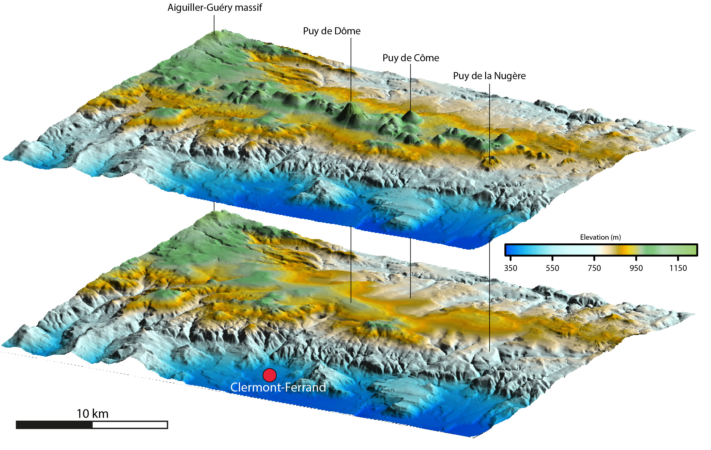
This dataset contains the results of the geological approach of the CAPRICE project. It includes processed data related to the pre-volcanic topography of the Chaîne des Puys, the thickness of volcanic products in the Chaîne des Puys, and information on the hydrogeology of the Chaîne des Puys. These data are intended for researchers working on the Chaîne des Puys, as well as for water resource managers and local authorities affected by the geographical scope of the dataset. The downloadable ZIP package contains : - Shapefile for Contour_Lines_prevolcanic_topography_Chaine_des_Puys_CAPRICE_2024 - Shapefile for Hydrogeological_Watershed_Chaine_des_Puys_CAPRICE_2024 - Shapefile for Outlets_watershed_Chaine_des_Puys_CAPRICE_2024 - DEM_prevolcanic_topography_Chaîne des Puys_CAPRICE_2024.asc - Volcanic_cover_thickness_CAPRICE_2024.asc | 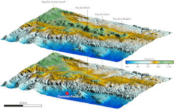 | |
| Downloads and links | ||
| Data | Prevolcanic_topography_of_the_Chaine_des_Puys_AUMAR_2024.zip | |
| | DataCite - XML - JSON | |
| Interoperable | https://catalog.opgc.uca.fr/geonetwork2/srv/eng/catalog.search#/metadata/6a235bdd-2866-4beb-9c56-fbca25cde90e | |
| Links | https://www.opgc.fr/DOI/DataResearch/r1pr-g644/3D_DEM_Chaîne%20des%20Puys_CAPRICE-01.jpg | |
| DOI | https://doi.org/10.25519/R1PR-G644 DOI https://doi.org/10.25519/ZGHC-N543 Self Potential data base on the Chaîne des Puys | |
About this resource | ||
| Keywords | Geology, Chaîne des Puys, Geological modelling, Hydrogeology, Watershed, CAPRICE, Dataset | |
Ressource Type | Dataset | |
| License | Creative Commons Attribution 4.0 International | |
Funding references | ||
| Creators | Cyril Aumar, Philippe Labazuy, Olivier Merle, Solène Buvat, Charley Merciecca | |
Creation date | 2018-01-01 | |
| Publisher | OPGC, LMV | |
Publication year | 2024 | |
Technical information | ||
Spatial extent | ||
| Formats | ESRI_shapefile, ASCII, JPG | |
| Software | ||
| Lineage | ||